Alice Springs To Kings Canyon Via Stuart & Lasseter Highways
We got up nice and early and left camp at The National Road Transport Hall Of Fame Museum just outside Alice Springs and headed to Kings Canyon. Originally our plan was to travel the Mereenie Loop however after talking to a few people that had just completed that trip we decided to give it a miss and go that way next time. General consensus was that the Mereenie Loop was in pretty poor condition due to a few recent rain events. So discretion being the better part of valour and all that we decided to be pussies for a change and go the easy route along the bitumen.
Driving from Alice Springs to Kings Canyon is one of the great ways to experience the vast beauty of Australia’s Red Centre. This scenic route takes you through the heart of the outback. You’ll see rugged landscapes, desert plains and some of the Northern Territory’s most famous landmarks. While it’s a long drive the sealed roads of the Stuart Highway and Lasseter Highway make it accessible to most vehicles. In this blog post we’ll cover driving directions, things to do along the way and some really great activities at Kings Canyon.
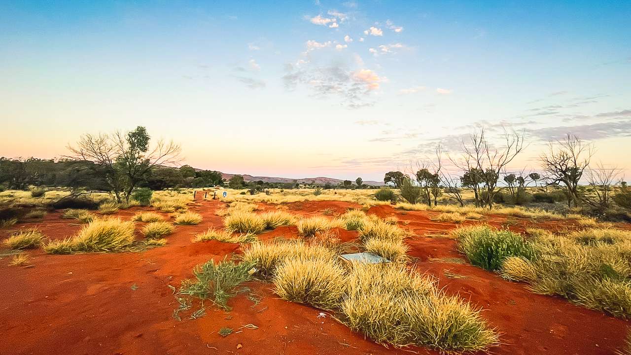
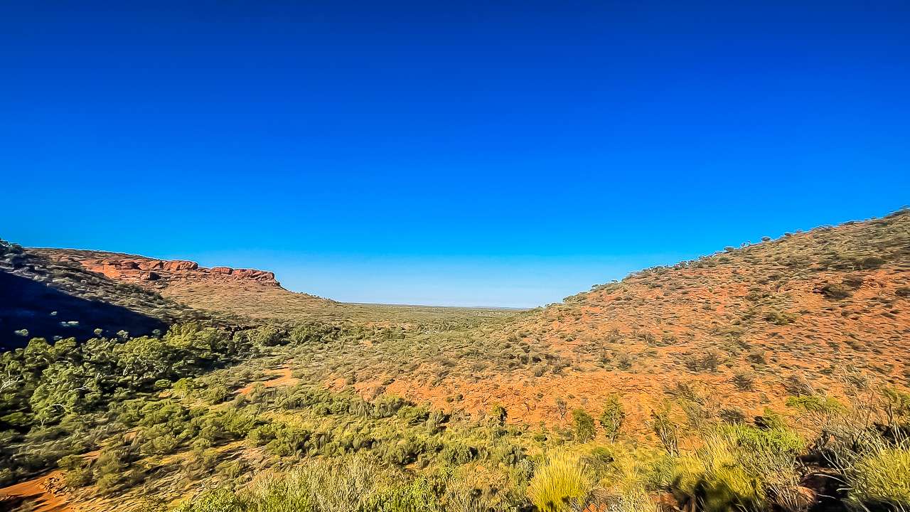
View From Kings Canyon Resort Campgrounds
Table Of Contents
- Overview Of The Drive
- Driving Directions From Alice Springs To Kings Canyon
- Things To Do On The Drive From Alice Springs To Kings Canyon
- Arriving At Kings Canyon
- Things To Keep In Mind For The Drive From Alice Springs To Kings Canyon
- Kings Canyon Entry Fee
- Final Thoughts On Driving from Alice Springs To Kings Canyon
- Kings Canyon Photo Gallery
Overview Of The Drive
The Kings Canyon to Alice Springs sealed road distance is approximately 475 kilometres and takes about 5 to 6 hours of driving time depending on your pace and stops along the way. Unlike the Mereenie Loop this route is fully sealed making it suitable for standard vehicles, caravans and campervans. The roads are usually in good condition (they were this trip) but as with any outback roads you’ll want to stay prepared with plenty of fuel, water and supplies.
Driving Directions From Alice Springs To Kings Canyon
Here’s a step-by-step guide to get you from Alice Springs to Kings Canyon.
- Start in Alice Springs: Head south on the Stuart Highway (Route 87) from Alice Springs. This is the main highway that runs through the Red Centre and connects Darwin to Adelaide.
- Stop at the Erldunda Roadhouse: After about 200 kilometres, you’ll reach Erldunda, which is known as the “Gateway to the Red Centre.” It’s a great place to fuel up, grab a bite or stretch your legs before continuing your journey.
- Turn onto Lasseter Highway: At the Erldunda Roadhouse, turn right onto the Lasseter Highway (Route 4). This road takes you west towards Kings Canyon and Uluru.
- Drive towards Luritja Road: After approximately 113 kilometres on the Lasseter Highway, you’ll reach the turnoff for Luritja Road. Turn right here and follow Luritja Road for about 170 kilometres until you arrive at Kings Canyon.
This straightforward route avoids any unsealed roads making it a popular choice for travellers who prefer a smoother ride or who don’t have a 4WD.
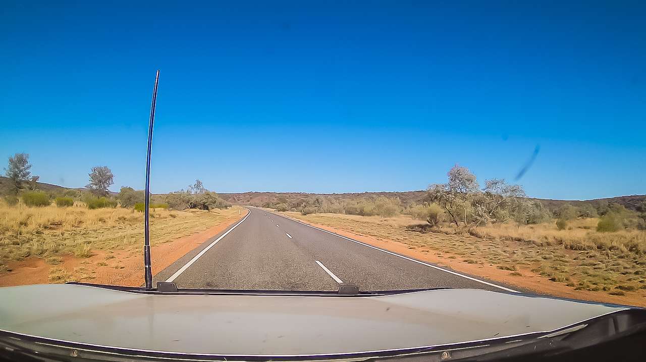
Luritja Road Between Kings Creek Station And Kings Canyon Alice Springs To Kings Canyon Drive
Things To Do On The Drive From Alice Springs To Kings Canyon
While the drive from Alice Springs to Kings Canyon is long there are several interesting stops along the way. Taking the time to explore these spots will not only break up the drive but also give you a chance to experience more of the outback’s unique landscapes and history.
- Erldunda Roadhouse
Erldunda is a key stopping point on your drive. The roadhouse offers fuel, food and accommodation if you need a break. It’s also home to the famous Emu Farm, where you can meet the resident emus. It’s a bit of a quirky stop, but worth it if you want to stretch your legs and snap a few photos of these giant birds. - Mount Ebenezer Roadhouse
Mount Ebenezer Roadhouse is now closed. It’s been closed since 2019. Located about halfway between Alice Springs and Kings Canyon Mount Ebenezer Roadhouse used to be a good spot to refuel and grab some snacks. You can still have a look at it but unfortunately nothing more than that. - Kings Creek Station
About 30 kilometres before Kings Canyon, you’ll find Kings Creek Station. This working cattle and camel station is another excellent stop if you want to experience outback life. The station offers a range of activities, including camel rides, quad biking and even helicopter flights over the area. There’s also a café where you can grab a coffee or a snack. It’s a great place to pause before the final stretch of your drive. - Geocaching
If you’re into geocaching and you have your app open on your phone you’ll find several geocaches along the drive from Alice Springs to Kings Canyon Via the Stuart and Lasseter Highways.
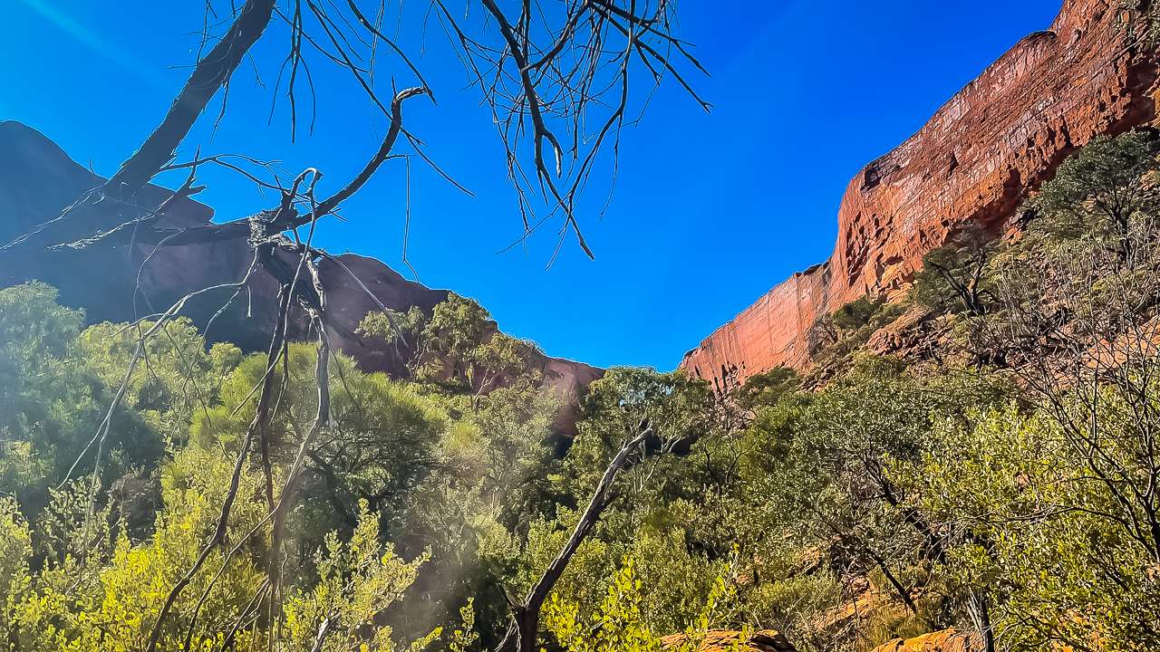
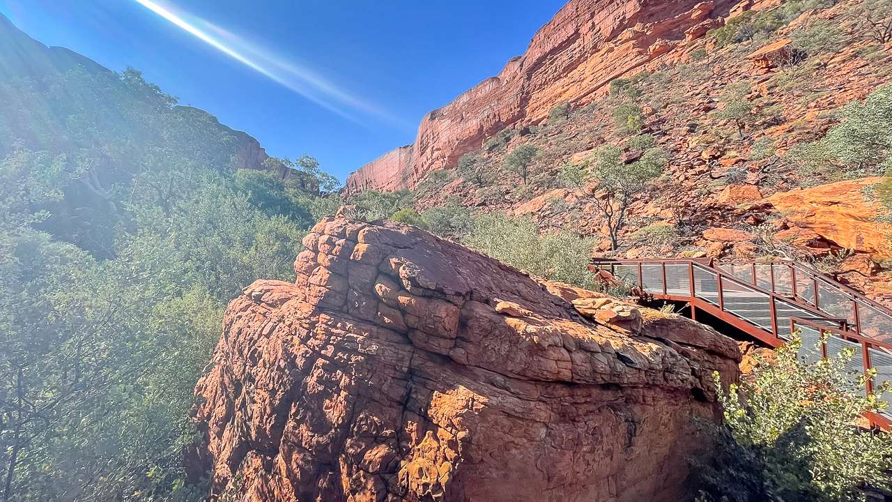
On The Creek Walk At Kings Canyon
Arriving At Kings Canyon
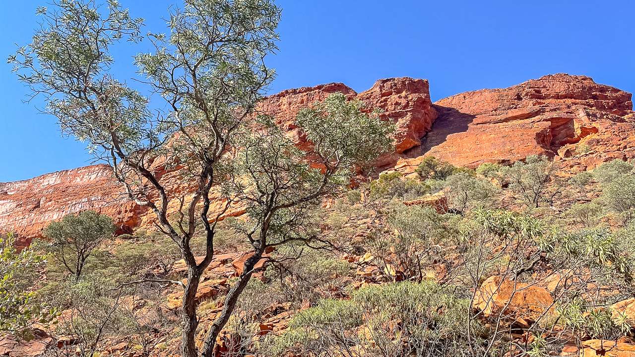
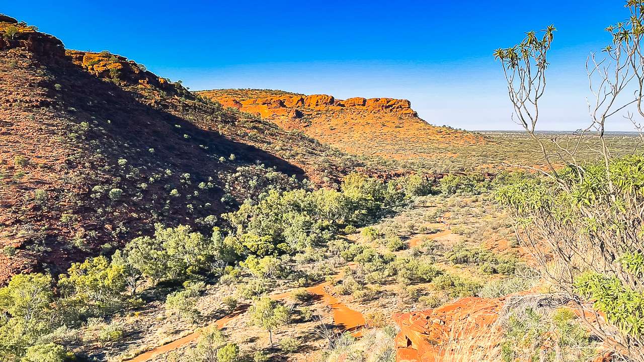
After hours of driving through the outback arriving at Kings Canyon feels like reaching an oasis. Located within Watarrka National Park Kings Canyon is a spectacular natural wonder with its towering red cliffs, lush valleys and ancient rock formations. There’s plenty to do once you arrive whether you’re after a challenging hike or a relaxing day of exploring.
- Kings Canyon Rim Walk
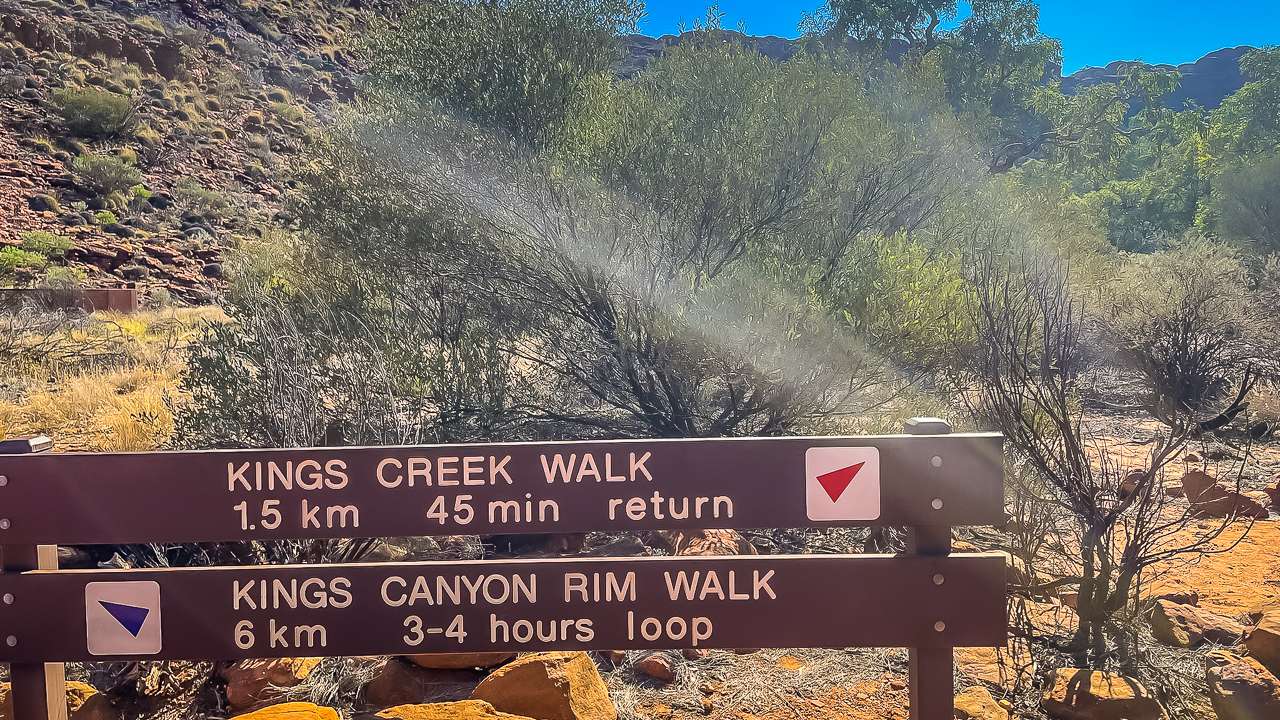
The Kings Canyon Rim Walk is the main attraction here and should be at the top of your list. The clearly marked 6 kilometre loop walk takes around 3 to 4 hours to complete and gives outstanding views of the canyon and the surrounding desert. The walk starts with a steep climb sometimes referred to as “Heart Attack Hill”, but once you reach the top the views are breathtaking. You’ll walk along the rim of the canyon taking in views of the sheer cliffs, rock formations like the “Lost City” and the Garden of Eden a tranquil waterhole surrounded by lush greenery. I managed to walk almost to the top of the steep climb however as Amanda is terrified of heights she couldn’t do it. So after getting to near the top I turned around and came back down. Just as I got back down to the bottom the park ranger was putting a sign out closing the walk for the rest of the day. They close the walk when they expect temperatures above 35 degrees celsius. Just as well they closed the walk as it got well above that! - Kings Creek Walk
If you’re looking for an easier and shorter walk the Kings Creek Walk is a great option. This 2 kilometre return walk takes you along the creek bed offering views of the towering canyon walls above. The trail is pretty flat and is shaded in parts making it a great option if you’re visiting in the heat of the day. There are seats along the way where you can take a break and there is a really good viewing platform at the end with good seating where you can sit back and relax before heading back. Amanda and I both did this walk and it was quite easy and with a lot to look at. - The Garden of Eden
Located along the Rim Walk, the Garden of Eden is a hidden oasis at the bottom of the canyon. This sheltered waterhole is surrounded by native plants and offers a peaceful place to rest or even take a dip (swimming is allowed, but the water can be quite cold!). It’s a stark contrast to the dry desert landscape above and a perfect spot for photos. - Helicopter Flights
For those who want to experience Kings Canyon from a different perspective, helicopter flights are available from Kings Creek Station and Kings Canyon Resort. These flights offer a bird’s-eye view of the canyon and surrounding landscape and while they’re not cheap they do provide a unique and unforgettable experience. - Kings Canyon Resort
Whether you’re staying overnight or even longer Kings Canyon Resort is a great base for exploring the area. The resort offers a range of accommodation, from campsites to luxury “glamping” tents. There’s also a restaurant, bar and shop on-site. During the dry season, you can enjoy live entertainment under the stars with the “Outback BBQ and Show,” where you can tuck into a hearty meal and enjoy some classic Aussie tunes.
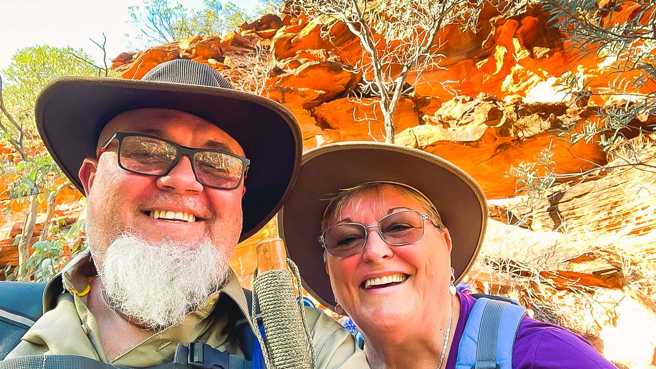
Selfie On The Kings Canyon Creek Walk
Things To Keep In Mind For The Drive From Alice Springs To Kings Canyon
While the route via the Stuart and Lasseter Highways is well maintained and easy to follow, it’s still important to stay prepared for the outback environment. Here are some things to consider before heading off:
- Fuel: There are a few roadhouses along the way (like Erldunda and Kings Creek Station) but it’s always a good idea to fuel up when you can. Don’t wait until your tank is low before stopping, as the distances between fuel stops can be long. The stretch between Alice Springs and Erldunda is 273 kilometres with no fuel available in between. And between Erldunda and Kings Creek Station is 236 kilometres. There is fuel available at Kings Canyon.
- Water and Supplies: Carry plenty of water and snacks with you as the outback can be harsh especially in the summer months. It’s also a good idea to carry basic supplies like a spare tyre, tools and a first aid kit in case of any breakdowns.
- Wildlife: Keep an eye out for wildlife especially around dawn and dusk. Kangaroos, camels and cattle are common in the area and can wander onto the road. Drive slowly and carefully particularly in low light conditions.
- Weather: The Red Centre can be extremely hot during the day especially in summer. Make sure you wear sunscreen, a hat and carry plenty of water if you’re planning to do any hiking. In the winter months nights can get quite chilly so pack warm clothing.
Kings Canyon Entry Fee
There is a Kings Canyon entry fee. If you are visiting the Northern Territory (NT) you need a parks pass to visit most national parks and reserves including Watarrka National Park.
An NT parks pass will allow you to visit all parks and reserves managed by the NT Government for the dates you purchase the pass for.
| Pass Type | Adult | Child (5 to 17 years) | Family (2 adults and 4 children) |
|---|---|---|---|
| Day pass | $10 | $5 | $25 |
| 2 week pass | $30 | $15 | $75 |
| Open pass – valid for 12 months | $60 | $30 | $150 |
Who Needs A Parks Pass
If you’re a visitor to the NT, you need a parks pass for Watarkka National Park (Kings Canyon). NT residents don’t need a parks pass but may be asked to show proof of residency such as a valid NT driver licence.
Get Your Parks Pass
You can only get your parks pass online. Do this before you go as you likely won’t have mobile internet internet connection when you are at any of the trailheads (we didn’t). It’s a good idea to sort out your Kings Canyon entry fee before you go. Ours was checked by a ranger while we were on the creek walk. You must be logged in to the parks booking system before you can get a pass. It’s as easy as creating an account. Go to the parks booking system
Where You Need A Parks Pass
You can’t use the NT parks pass to enter Kakadu and Uluru-Kata Tjuta National Parks. These parks are managed by Parks Australia under the Australian Government, so you must get a separate pass from the Parks Australia website.
You need an NT parks pass for all of the below.
| National park or reserve | Region |
|---|---|
| Arltunga Historical Reserve | Central Australia |
| Barranyi (North Island) National Park | Katherine region |
| Blackmore River Conservation Reserve | Darwin region |
| Bullwaddy Conservation Reserve | Katherine region |
| Butterfly Gorge Nature Park | Darwin region |
| Caranbirini Conservation Reserve | Katherine region |
| Chambers Pillar Historical Reserve | Central Australia |
| Channel Point Coastal Reserve | Darwin region |
| Connells Lagoon Conservation Reserve | Barkly and Tennant Creek region |
| Corroboree Rock Conservation Reserve | Central Australia |
| Djukbinj National Park | Darwin region |
| Douglas River / Daly River Esplanade Conservation Area | Darwin region |
| Dulcie Range National Park | Central Australia |
| Elsey National Park | Katherine region |
| Finke Gorge National Park | Central Australia |
| Fogg Dam Conservation Reserve | Darwin region |
| Giwining / Flora River Nature Park | Katherine region |
| Gregory’s Tree Historical Reserve | Katherine region |
| Harrison Dam Conservation Reserve | Darwin region |
| Henbury Meteorites Conservation Reserve | Central Australia |
| Howard Springs Hunting Reserve | Darwin region |
| Illamurta Springs Conservation Reserve | Central Australia |
| Iytwelepenty / Davenport Ranges National Park | Barkly and Tennant Creek region |
| Judbarra / Gregory National Park | Katherine region |
| Karlu Karlu / Devils Marbles Conservation Reserve | Barkly and Tennant Creek region |
| Keep River National Park | Katherine region |
| Limmen Bight Marine Park | Katherine region |
| Limmen National Park | Katherine region |
| Litchfield National Park | Darwin region |
| Mac Clark (Acacia peuce) Conservation Reserve | Central Australia |
| Manton Dam Recreation Area | Darwin region |
| Mary River National Park | Darwin region |
| Napwerte / Ewaninga Rock Carvings Conservation Reserve | Central Australia |
| N’dhala Gorge Nature Park | Central Australia |
| Nitmiluk (Katherine Gorge) National Park | Katherine region |
| Oolloo Crossing Conservation Area | Darwin region |
| Owen Springs Reserve | Central Australia |
| Rainbow Valley Conservation Reserve | Central Australia |
| Ruby Gap Nature Park | Central Australia |
| Shoal Bay Coastal Reserve | Darwin region |
| Stray Creek Conservation Area | Darwin region |
| Tjoritja / West MacDonnell National Park | Central Australia |
| Tnorala (Gosse Bluff) Conservation Reserve | Central Australia |
| Trephina Gorge Nature Park | Central Australia |
| Tree Point Conservation Area | Darwin region |
| Umbrawarra Gorge Nature Park | Darwin region |
| Watarrka National Park | Central Australia |
Final Thoughts On Driving from Alice Springs To Kings Canyon
Driving from Alice Springs to Kings Canyon via the Stuart and Lasseter Highways is an unforgettable journey through some of Australia’s most iconic outback landscapes. The sealed roads make it a comfortable and accessible drive and the stops along the way offer a glimpse into the region’s unique culture, history and natural beauty. Whether you’re up for a long hike along the canyon rim or simply want to take in the sights Kings Canyon is a stunning destination that rewards every kilometre you’ve travelled. So pack your gear, load up the car and get ready for an epic road trip through the heart of Australia’s Red Centre – you won’t be disappointed!
Viewing Platform At The End Of The Creek Walk At Kings Canyon
Kings Canyon Photo Gallery
View From Kings Canyon Resort Campgrounds
View From Kings Canyon Resort Campgrounds
View At Kings Canyon
View At Kings Canyon
Walks At Kings Canyon
Walks At Kings Canyon
View From Kings Canyon Rim Walk Start Of First Big Climb
View From Kings Canyon Rim Walk Start Of First Big Climb
View From Kings Canyon Rim Walk Halfway Up First Big Climb
View From Kings Canyon Rim Walk Halfway Up First Big Climb
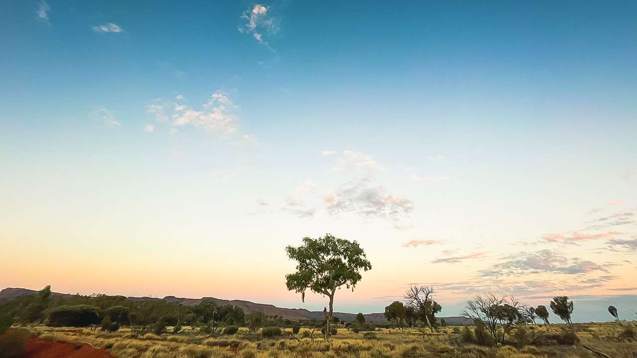
Sunset From Kings Canyon Resort
Sunset From Kings Canyon Resort
Selfie On The Kings Canyon Creek Walk
Selfie On The Kings Canyon Creek Walk
Viewing Platform At The End Of The Creek Walk At Kings Canyon
Viewing Platform At The End Of The Creek Walk At Kings Canyon
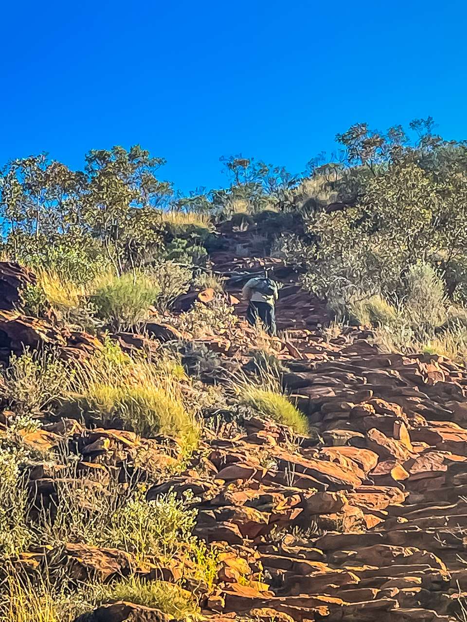
First Part of The Rim Walk At Kings Canyon Is Very Steep
First Part of The Rim Walk At Kings Canyon Is Very Steep
On The Creek Walk At Kings Canyon
On The Creek Walk At Kings Canyon
Luritja Road Between Kings Creek Station And Kings Canyon Alice Springs To Kings Canyon Drive
Luritja Road Between Kings Creek Station And Kings Canyon Alice Springs To Kings Canyon Drive
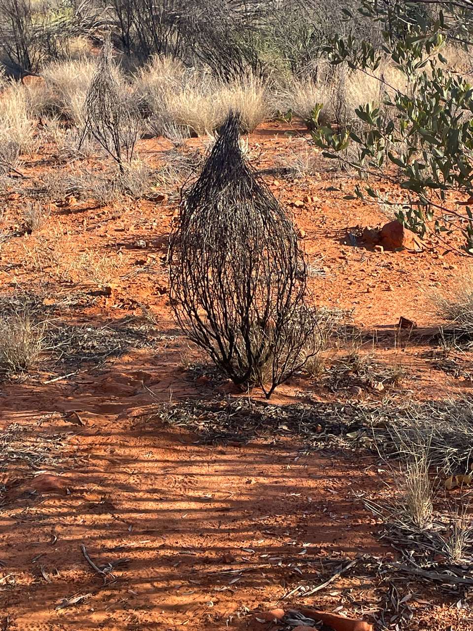
On Kings Canyon Alice Springs To Kings Canyon Drive Bush Near Kings Canyon They Look Like Baskets
On Kings Canyon Alice Springs To Kings Canyon Drive Bush Near Kings Canyon They Look Like Baskets